
Chicago once had one of the world’s largest streetcar systems, more than 500 miles of line on nearly 100 routes by 1935. Horsecar service began in 1859, and was supplanted in the 1880s by a large network of cable car lines. In the 1890s, electric “trolleys” proved more efficient and the cable cars were replaced by 1906. Beginning in 1914, the various companies holding franchises for different parts of the city operated as a single system known as Chicago Surface Lines. More than 3,700 large red streetcars plied the city’s streets by 1935, and 680 new streamlined green PCC cars began arriving after World War II. The new public agency Chicago Transit Authority took over the streetcar system in 1947 and began to integrate the surface lines with the city’s elevated train network. In the 1950s, CTA decided to phase out streetcars in favor of motor and electric trolley buses, and Chicago’s last streetcar ran in June 1958.  TO LEARN MORE:A fact sheet from Shore Line Interurban Historical Society Street Railways, an entry from the Encyclopedia of Chicago Bill Vandervoort's Chicago Surface Lines pages These books (both out of print) offer more details: Lind, Alan R. Chicago Surface Lines: An Illustrated History Johnson, James D. A Century of Chicago Streetcars This map dates from 1937, the peak year for track mileage: 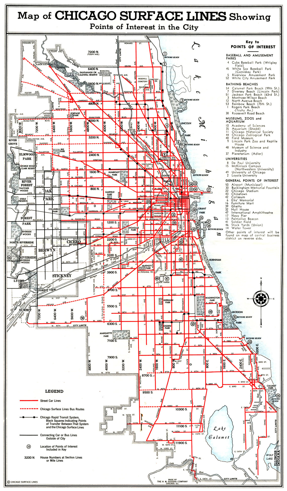 Click for more info and great maps chicagoinmaps.com |
Chicago Streetcars
Subscribe to:
Post Comments (Atom)
Free E-book "Readings in Urban Planning and Design"
Readings in Urban Planning and Design This manuscript expands upon, and compliments, chapters in the book “Planning Connections – Human, Nat...

-
 The Russians have never stopped their disinformation and commentary on the internet. It is obvious that many of the angry comments on the in...
 -
 A blog (a truncation of "weblog") is a discussion or informational website published on the World Wide Web consisting of discret...
 -
 I nteresting article in Forbes. It is high time to think about moving your business and home to Peoria. Typical morning commute is 10 or 15...
No comments:
Post a Comment